History

Articles in this section, each with its sources.

6 topics availableSearch all sections
Image credits
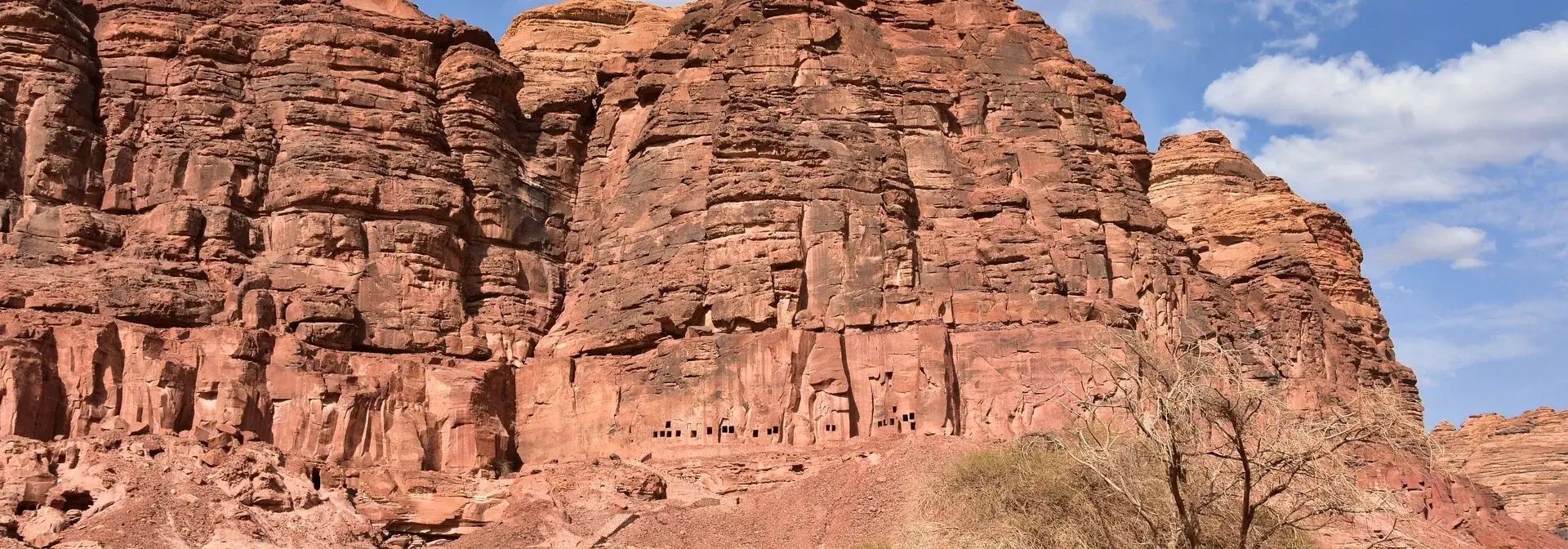
Image attribution: Madain Saleh 1 — KHAWAJA UMER FAROOQ (Kufarooq), CC BY-SA 4.0, via Wikimedia Commons. Source: https://commons.wikimedia.org/wiki/File:Madain_Saleh_1.jpg ; license: https://creativecommons.org/licenses/by-sa/4.0/ . Proportionally resized by Wikimedia. CMS derivative: converted to WebP at quality 85; proportionally resized within 2400 × 2400 without enlargement where needed. Card/hero display may crop to fit; original composition is not retouched. / نسخة CMS: تحويل إلى WebP بجودة 85 وتصغير تناسبي عند الحاجة ضمن 2400 × 2400 دون تكبير؛ قد يقتطع العرض داخل البطاقات أو رأس المقال أطراف الصورة، دون تنقيح محتواها. · License: CC BY-SA 4.0 International — https://creativecommons.org/licenses/by-sa/4.0/
Archaeological sites

History of Hegra

Hegra, also called Mada'in Salih, is an archaeological site in AlUla Governorate whose tombs, wells and inscriptions illuminate Nabataean life and caravan routes.

Read article
Image credits
Image attribution: Heritage Commission — Own work, CC BY-SA 4.0, via Wikimedia Commons. Modified: cropped and resized to 1920×672 (horizontal band cropped from the centre of the original) to fit the article cover. / «هيئة التراث» (Heritage Commission) — عمل شخصي، رخصة CC BY-SA 4.0، عبر ويكيميديا كومنز. عُدِّلت الصورة بقصّها وتغيير مقاسها إلى 1920×672 (شريط أفقي من منتصف الصورة الأصلية) لتناسب غلاف المقالة. · License: CC BY-SA 4.0
منتصف الألفية الأولى قبل الميلاد – القرن الخامس الميلادي

Qaryat al-Faw

Qaryat al-Faw is an archaeological site in Wadi ad-Dawasir Governorate, south of the Riyadh Region, also known as Dhat Kahil, and served as the capital of the Kingdom of Kindah from the fourth century BCE until the early fourth century CE. The Cultural Landscape of Al-Faw Archaeological Area was inscribed on the World Heritage List in 2024.

Read article
Image credits
Image attribution: Prof. Mortel — 'Site of al-Ukhdud, Najran, Saudi Arabia', CC BY 2.0, via Wikimedia Commons. Modified: cropped to 1920×672 to fit the article cover (no upscaling). / Prof. Mortel — «موقع الأخدود الأثري بنجران»، رخصة CC BY 2.0، عبر ويكيميديا كومنز. عُدِّلت: قُصّت إلى 1920×672 لتلائم غلاف المقالة دون تكبير. · License: CC BY 2.0
الألف الأول قبل الميلاد–القرن الرابع الميلادي

Al-Akhdood

Al-Akhdood is an archaeological site in the Najran Region of south-western Saudi Arabia. It represents the ancient city of Najran and its commercial market on the caravan route, is associated with the story of the Companions of the Trench mentioned in the Holy Quran, and today stands as a living open-air museum welcoming visitors.

Read article
Image credits
Image attribution: Richard Mortel — «Ancient site of Dadan at al-Ula, 1st millenium BCE, Saudi Arabia 11» — رخصة CC BY 2.0، عبر ويكيميديا كومنز (عُدِّلت: قُصّت إلى 1920×672 لتناسب غلاف المقالة، دون تكبير). · License: CC BY 2.0
من أواخر القرن التاسع قبل الميلاد

Kingdom of Dadan

The Kingdom of Dadan is an ancient Arabian kingdom in the northwest of the Arabian Peninsula; the city of Dadan was its historic capital and later the capital of the Kingdom of Lihyan, with its period extending from the late ninth century BCE. It is located in AlUla Governorate and contains tombs carved into red rock slopes and Dadanitic inscriptions on Jabal Ikmah.

Read article
القرن السادس قبل الميلاد – القرن الثاني قبل الميلاد

Kingdom of Lihyan

The Kingdom of Lihyan is an ancient Arab kingdom that flourished in the northwest of the Arabian Peninsula, specifically in the AlUla region, and it followed the Kingdom of Dadan in ruling the area. Its influence extended from the sixth century to the second century BC. Its inscriptions documented its religious thought, its offerings, its civilisational standing and its school of sculpture, and among the most prominent sites connected with it are the Umm Daraj site and the Al-Khuraybah site.

Read article
Image credits
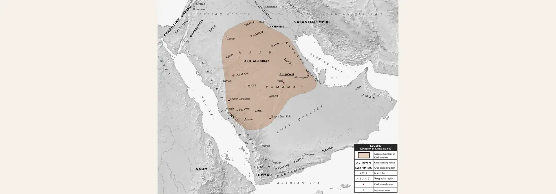
Image attribution: Map: Al Ameer son — “Kindite Kingdom, ca. 500” (own work) — Source: Wikimedia Commons, file “Kindite Kingdom, ca. 500.png” — https://commons.wikimedia.org/wiki/File:Kindite_Kingdom,_ca._500.png — License: CC BY-SA 4.0 (Creative Commons Attribution-ShareAlike 4.0) — https://creativecommons.org/licenses/by-sa/4.0 — Modified: the full map was placed at its original size 1573×1270, uncropped and not enlarged (downscaled only to a height of 672), on a 1920×672 canvas over a soft cream (#f4efe5) backdrop derived from the map itself. / خريطة: Al Ameer son — «Kindite Kingdom, ca. 500» (عمل شخصي) — المصدر: ويكيميديا كومنز، ملف «Kindite Kingdom, ca. 500.png» — https://commons.wikimedia.org/wiki/File:Kindite_Kingdom,_ca._500.png — الرخصة: CC BY-SA 4.0 (المشاع الإبداعي نَسب المُصنَّف – الترخيص بالمثل 4.0) — https://creativecommons.org/licenses/by-sa/4.0 — عُدِّلت: وُضعت الخريطة كاملة بحجمها الأصلي 1573×1270 دون قصّ ولا تكبير (تصغير فقط إلى ارتفاع 672) على كانفس 1920×672 بخلفية كريميّة مموّهة (#f4efe5) مشتقّة من الخريطة نفسها. · License: CC BY-SA 4.0
منتصف الألف الأول قبل الميلاد – القرن الخامس الميلادي

Kingdom of Kinda

The Kingdom of Kinda was an ancient Arabian entity built on a federal organisation of Arabian desert tribes, with the archaeological city of Qaryat al-Faw in Wadi ad-Dawasir Governorate as its capital. The Cultural Landscape of the Al-Faw Archaeological Area was inscribed on the World Heritage List in 2024 CE, and it is managed by the Heritage Commission of the Ministry of Culture and the National Centre for Wildlife.

Read article