Wadis
Image credits
Image attribution: Lake at Wadi Hanifah (5218227168) — Peter Dowley from Dubai, United Arab Emirates, via Wikimedia Commons, CC BY 2.0. Source: https://commons.wikimedia.org/wiki/File%3ALake_at_Wadi_Hanifah_(5218227168).jpg ; license: https://creativecommons.org/licenses/by/2.0 . CMS derivative: converted to WebP at quality 85; proportionally resized within 2400 × 2400 without enlargement where needed. / نسخة CMS: تحويل إلى WebP بجودة 85 وتصغير تناسبي عند الحاجة ضمن 2400 × 2400 دون تكبير. ·
License: CC BY 2.0 — https://creativecommons.org/licenses/by/2.0 Wadis
A seasonal watercourse in central Saudi Arabia about 160 km long, rising west of Al-Uyaynah and ending in the Al-Sahba sands, on whose banks Diriyah and Riyadh grew.
Read article→ Wadis
Image credits
Image attribution: Wadi al-Rummah Al Badayea Nov 2018 -4 — Slayym, via Wikimedia Commons, CC BY-SA 4.0. Source: https://commons.wikimedia.org/wiki/File%3AWadi_al-Rummah_Al_Badayea_Nov_2018_-4.jpeg ; license: https://creativecommons.org/licenses/by-sa/4.0 . CMS derivative: converted to WebP at quality 85; proportionally resized within 2400 × 2400 without enlargement where needed. / نسخة CMS: تحويل إلى WebP بجودة 85 وتصغير تناسبي عند الحاجة ضمن 2400 × 2400 دون تكبير. ·
License: CC BY-SA 4.0 — https://creativecommons.org/licenses/by-sa/4.0 Wadis
The Kingdom's longest seasonal watercourse, about 510 km, rising in the Khaybar lava field and crossing seven governorates of Hail and Al-Qassim to the Thuwayrat sands.
Read article→ Wadis
Image credits
Image attribution: Photographer Saif Arash — CC BY 4.0, via Wikimedia Commons (File: Wadi Bisha in Saudi Arabia IMG 2484.jpg). Modified: placed complete, without cropping or enlargement, on a blurred cream background at 1920×672 to fit the article cover. / المصوّر Saif Arash — رخصة CC BY 4.0 عبر ويكيميديا كومنز (ملف: Wadi Bisha in Saudi Arabia IMG 2484.jpg). عُدِّلت: وُضعت كاملة دون قص ودون تكبير على خلفية كريمية مموّهة بمقاس 1920×672 لتناسب غلاف المقالة. · License: CC BY 4.0
2004م–2021م
Wadi Bisha is a wadi among the largest of the Arabian Peninsula, in Bisha Governorate in the Asir Region, and its length exceeds 450 kilometres. King Fahd Dam stands on its course with a storage capacity of 325 million cubic metres, and along its banks are date-palm cultivation, the 'Al-Sifri' dates, and rock carvings numbering more than 10,000.
Read article→ Wadis
Image credits
Image attribution: Saif Arash — Wikimedia Commons, CC BY 4.0. Adapted: resized to 1920×672 and placed uncropped on a blurred cream background. / سيف عرش (Saif Arash) — ويكيميديا كومنز، رخصة CC BY 4.0. عُدِّلت الصورة بتحويلها إلى 1920×672 ووضعها كاملة دون قص على خلفية مموّهة كريمية. · License: CC BY 4.0
2017م–2025م
Wadi Lajab is a fault gorge in the eastern part of Jabal al-Qahr in Al-Rayth governorate, Jazan Region. It extends about 11 kilometers and holds hanging gardens of tall palms, freshwater springs and a rock resembling a human head, making it one of the most prominent natural and tourist landmarks in northern Jazan Region and among the Kingdom's leading destinations.
Read article→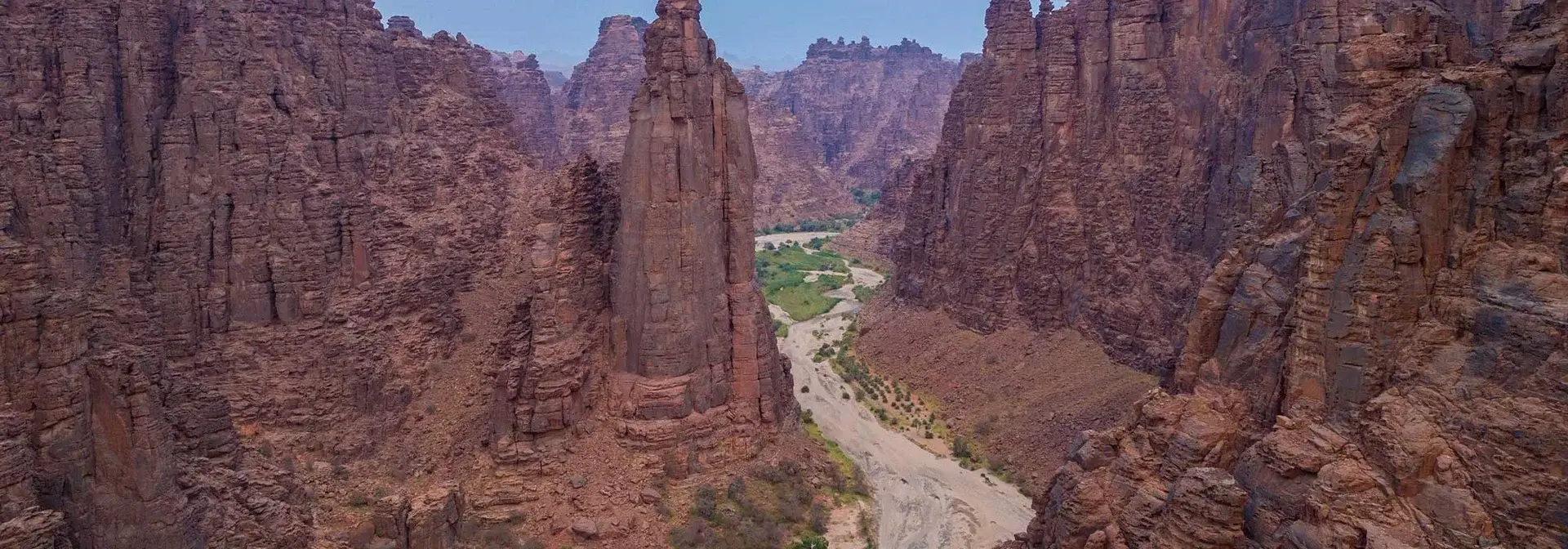 Wadis
Image credits
Image attribution: Source: Saudipedia (the official Saudi encyclopedia, Ministry of Media) — page image of "الأودية والعيون في الديسة", captioned "صورة من الأعلى لوادي الديسة في منطقة تبوك" (aerial photo of Wadi al-Disah, Tabuk region); modified by cropping to a 1920x672 cover. / المصدر: سعوديبيديا (الموسوعة السعودية الرسمية، وزارة الإعلام) — صورة صفحة «الأودية والعيون في الديسة»، تعليقها على المصدر: «صورة من الأعلى لوادي الديسة في منطقة تبوك»؛ عُدِّلت بقصّها إلى غلاف 1920×672. · License: © سعوديبيديا — وزارة الإعلام السعودية (جميع الحقوق محفوظة)
623هـ – 2022م
Wadi Disah is a valley in the north-west of the Prince Mohammed bin Salman Royal Reserve and the south-west of the Tabuk region, about 200 km south-west of the city of Tabuk. It holds freshwater springs, towering rock pillars and Nabataean tombs carved into the rock, and its farms produce mango and nabq; it lies within a development project announced by the Public Investment Fund.
Read article→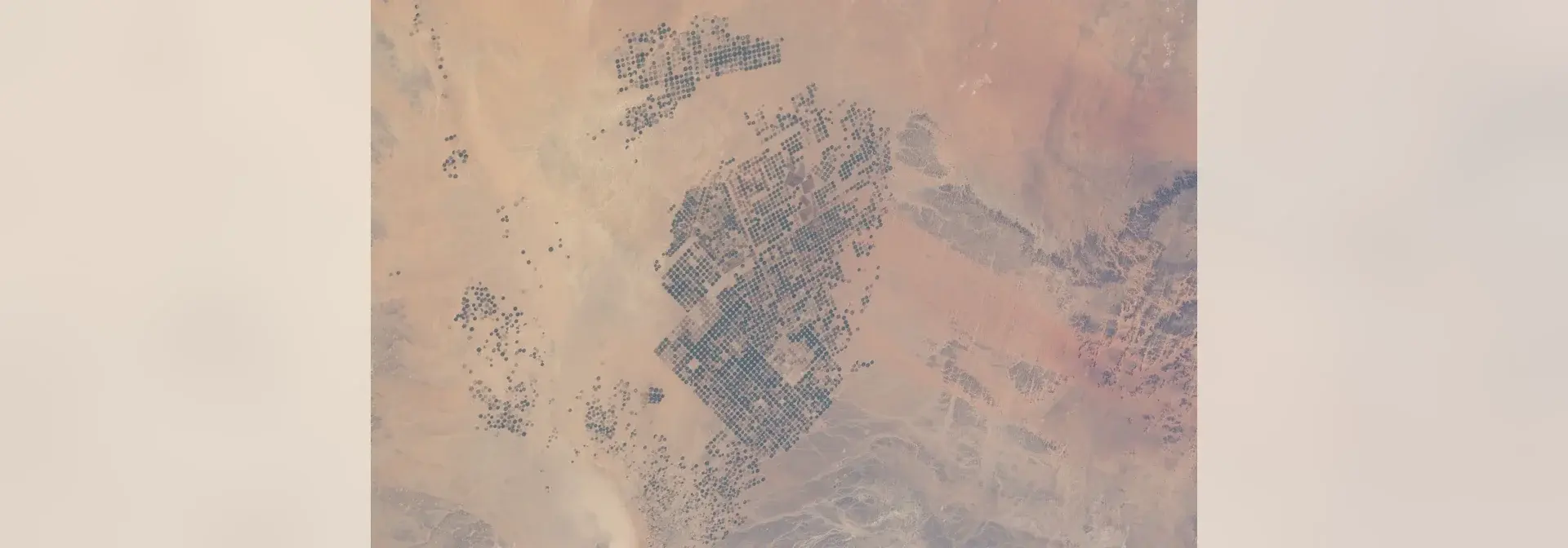 Wadis
Image credits
Image attribution: Wadi Sirhan (Wadi As-Sirhan Basin, Al-Jawf, Saudi Arabia) — space photograph by the Expedition 30 crew aboard the International Space Station, frame ISS030-E-090918, 21 February 2012, via Wikimedia Commons, file "ISS-30 Agricultural fields in the Wadi As-Sirhan Basin in Saudi Arabia.jpg"; author: NASA (ISS crew); license: Public domain (PD-USGov-NASA); declared source: http://spaceflight.nasa.gov/gallery/images/station/crew-30/html/iss030e090918.html — file page: https://commons.wikimedia.org/wiki/File:ISS-30_Agricultural_fields_in_the_Wadi_As-Sirhan_Basin_in_Saudi_Arabia.jpg — modification: downscaled only (no upscaling, no cropping) and placed whole and sharp in the centre of a 1920×672 canvas with a cream background #f4efe5 carrying a blurred copy of the same photograph. / وادي السرحان (حوض وادي السرحان، منطقة الجوف، السعودية) — صورة فضائية التقطها طاقم البعثة 30 في محطة الفضاء الدولية، رقم الإطار ISS030-E-090918، بتاريخ 21 فبراير 2012، عبر ويكيميديا كومنز، ملف «ISS-30 Agricultural fields in the Wadi As-Sirhan Basin in Saudi Arabia.jpg»؛ المؤلف: NASA (طاقم محطة الفضاء الدولية)، رخصة: ملكية عامة (Public domain — PD-USGov-NASA)، المصدر المعلن: http://spaceflight.nasa.gov/gallery/images/station/crew-30/html/iss030e090918.html — صفحة الملف: https://commons.wikimedia.org/wiki/File:ISS-30_Agricultural_fields_in_the_Wadi_As-Sirhan_Basin_in_Saudi_Arabia.jpg — تغيير أُجري: تصغير فقط (بلا تكبير وبلا قص) ووضع الصورة كاملة حادّة في وسط كانفس 1920×672 بخلفية كريميّة #f4efe5 تحمل نسخة مموّهة من الصورة نفسها. ·
License: Public domain (PD-USGov-NASA) 1380هـ–
Wadi Sirhan is a wadi in the Al-Jawf region of northern Saudi Arabia and the longest and best-known wadi of the region, with a length of 180 km. It occupies the northern part of the region, where the surface falls below 300 m above sea level, and its name is linked to the project to settle the Bedouin and spread agriculture from 1380 AH.
Read article→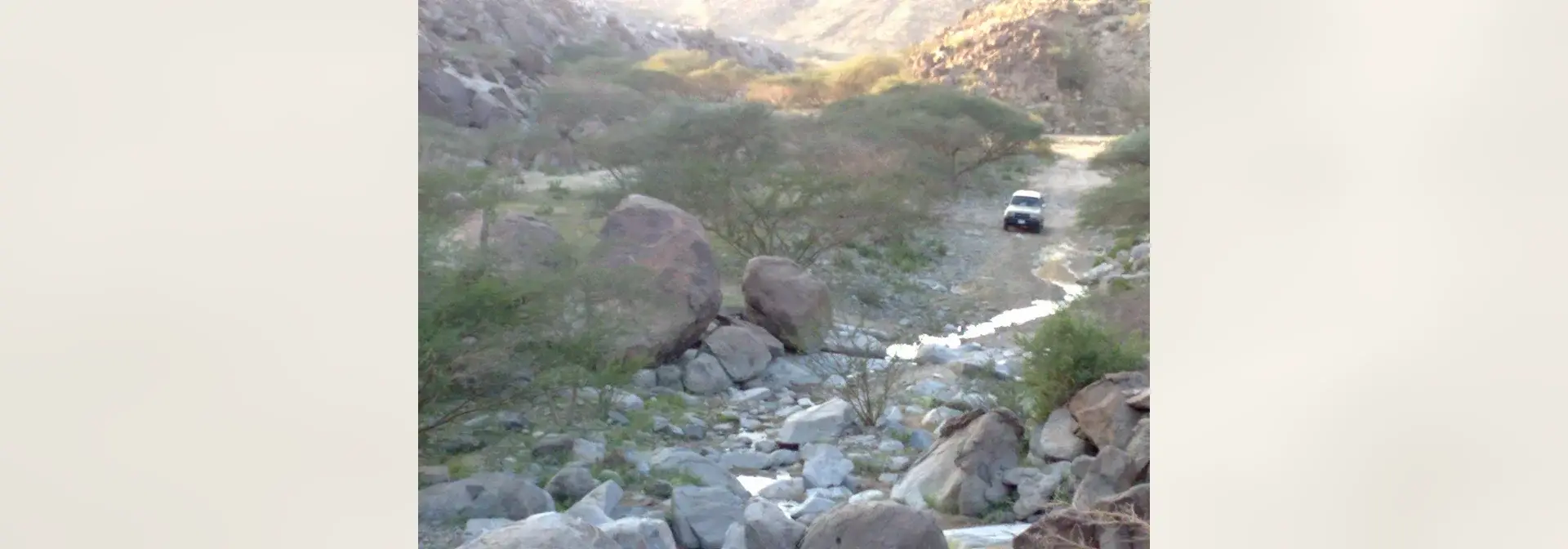 Wadis
Image credits
Image attribution: Photo: "وادي فاطمة - panoramio.jpg" by "معلم انجليزي" via Panoramio (24 December 2009), licensed CC BY 3.0, from Wikimedia Commons. Modified: placed uncropped and unscaled on a blurred cream (#f4efe5) canvas at 1920×672 to fit the article cover. / الصورة: «وادي فاطمة - panoramio.jpg» للمصوّر «معلم انجليزي» عبر بانوراميو (24 ديسمبر 2009)، رخصة CC BY 3.0، من ويكيميديا كومنز. عُدِّلت: وُضعت كما هي دون قص ولا تكبير على خلفية مموّهة كريمية (#f4efe5) بمقاس 1920×672 لتلائم غلاف المقالة. · License: CC BY 3.0
Wadis
Wadi Fatimah is one of the most important wadis in the west of the Kingdom of Saudi Arabia, and it belongs to the Makkah Region, with a length of up to 210 kilometres. It contains human settlement sites from the Stone Age and a dam that serves agriculture and farmers, and on its two banks stand governorates, centres and villages, most notably Al-Jumum and Bahrah.
Read article→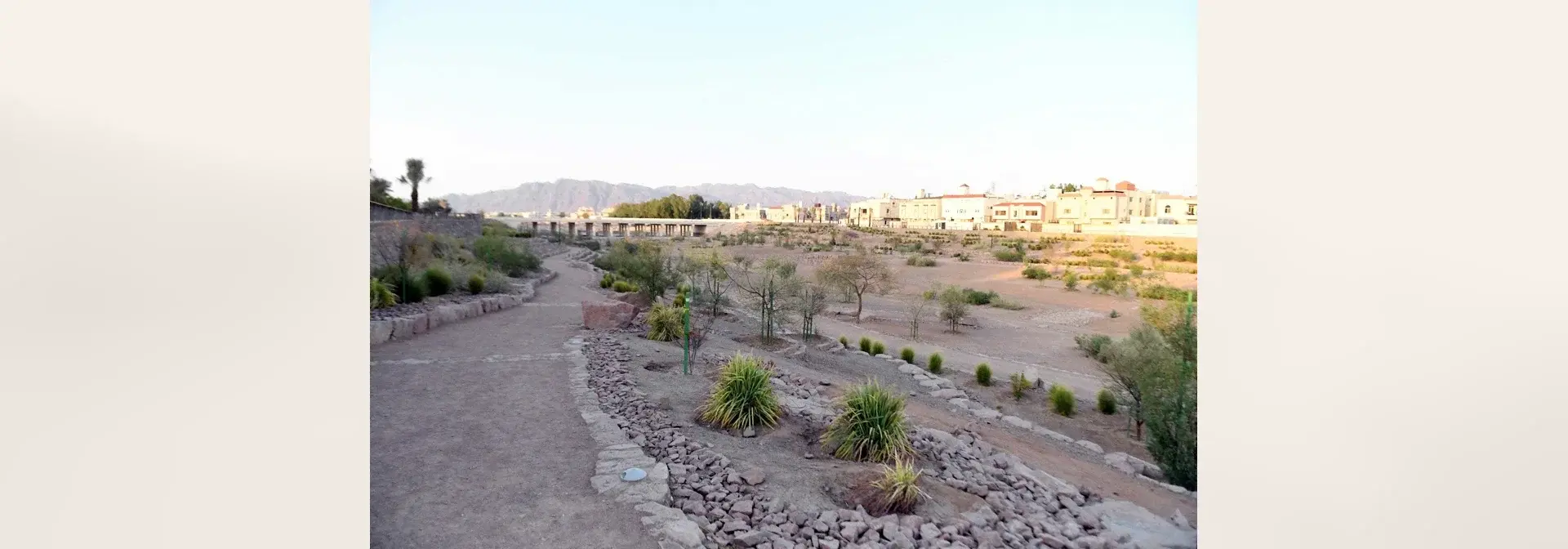 Wadis
Image credits
Image attribution: Lead image of the Saudipedia (Saudi Encyclopedia) entry «وادي العقيق في المدينة المنورة» (Wadi al-Aqiq in Madinah) — Copyright reserved to the Ministry of Media 2026. Source: https://saudipedia.com/وادي-العقيق-في-المدينة-المنورة / الصورة الرئيسية لصفحة «وادي العقيق في المدينة المنورة» في سعوديبيديا (الموسوعة السعودية) — حقوق النشر محفوظة لوزارة الإعلام 2026. المصدر: https://saudipedia.com/وادي-العقيق-في-المدينة-المنورة ·
License: © وزارة الإعلام / سعوديبيديا — جميع الحقوق محفوظة 2026 Wadis
Wadi Al-Aqiq is one of the best-known valleys of Madinah, lying in its south-western part, and is called the “Blessed Valley” for its connection to the purified Prophetic biography. It was a source of water and agricultural life, and today its banks carry walking paths, an environmental rehabilitation project and investment opportunities.
Read article→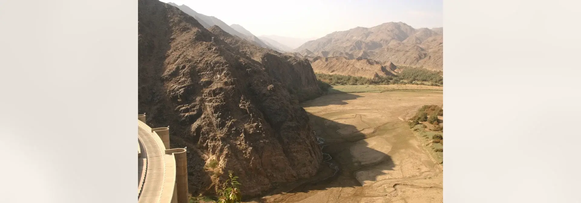 Wadis
Image credits
Image attribution: Photo by Retlaw Snellac Photography (Flickr), licensed under Creative Commons Attribution 2.0 (CC BY 2.0), via Wikimedia Commons — File:Wadi najran dam.jpg, described as «سد وادي نجران، منطقة نجران - السعودية» (Wadi Najran dam, Najran region, Saudi Arabia). Modified by placing it complete, uncropped and un-upscaled, on a blurred cream 1920×672 canvas to fit the article cover. / تصوير: Retlaw Snellac Photography (فليكر)، رخصة المشاع الإبداعي نَسب المُصنَّف 2.0 العمومية (CC BY 2.0)، عبر ويكيميديا كومنز — الملف: File:Wadi najran dam.jpg، ووصفه الحرفي «سد وادي نجران، منطقة نجران - السعودية». عُدّلت الصورة بوضعها كاملةً بلا قصٍّ ولا تكبير على لوحة كريمية مموّهة 1920×672 لتلائم غلاف المقالة. · License: CC BY 2.0
Wadis
Wadi Najran is the best known of the valleys of the fertile plain in the centre of Najran Region in the southwest of the Kingdom of Saudi Arabia, and it is linked to the archaeological site of Al-Akhdood, on which the ancient city of Najran stood. It runs through a fertile agricultural environment, and along its course stand facilities and landmarks including the Wadi Najran dam, opened in 1982.
Read article→