Overview
The Battle of Khaybar is an event in Islamic history associated with the oasis of Khaybar in the north-west of the Arabian Peninsula. It came after a phase of transition in the course of the Muslims in Madinah, in which they moved from defence to an offensive strategy in the aftermath of the Battle of the Trench.[2]
Khaybar is an ancient oasis and one of the natural wonders of the north-west of the Arabian Peninsula, formed by desert volcanic activity, and it has hosted human settlement for more than 100,000 years.[1] It is divided into a natural area that includes the volcanic landscapes of the Khaybar lava field, and a historical oasis that has remained a source of fresh water and culture for thousands of years.[1]
Between the Khaybar Lava Field and the Historical Oasis
In its natural area, Khaybar holds the volcanic landscapes of the Khaybar lava field, matched by a historical oasis distinguished by its biodiversity and by its role as a source of fresh water and culture for thousands of years.[1]
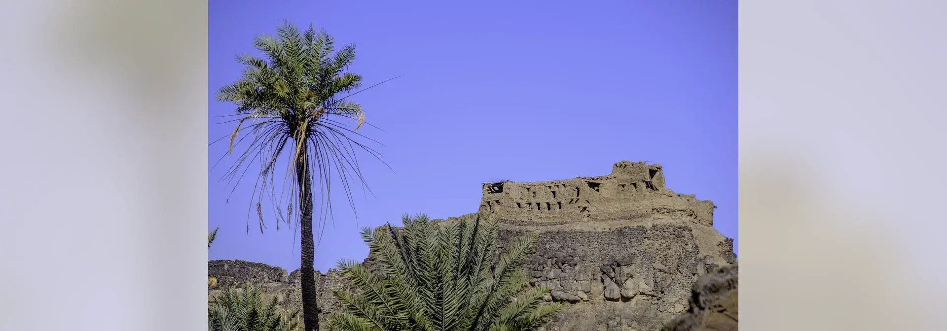
With these features of striking scenery and abundant fresh water, Khaybar became a seat sought by powers throughout history, as the remains of its fortresses show, together with craft traditions that still testify to its past civilisation.[1]
Khaybar on the Caravan Route
The main trade route of the north-west of the Arabian Peninsula ran through Makkah and Madinah, then Khaybar, then AlUla, then Mada'in Salih, that is Hegra, and at that point a branch of it turned towards Tayma in the direction of Iraq.[3]
Khaybar thus stood on one of the principal roads that linked the cities of the north-west of the Arabian Peninsula to one another, a position bound up with caravan traffic in the region before Islam and after it.[3]
The Context of the Battle
A strategic shift preceded the battle: after the Battle of the Trench the Muslims moved to an offensive strategy, stormed the last Jewish stronghold in Madinah in the siege of Banu Qurayzah, and cleared Madinah and its surroundings of those who had posed the greatest danger to the Muslim presence.[2]
At the time of the battle, Khaybar was an oasis with fresh water, scenery and the remains of fortresses, the very features that had made it a seat sought by powers throughout history.[1]
Khaybar's Antiquities: Al-Natah and the Bronze Age Barrier
Khaybar's site preserves archaeological evidence from the Bronze Age, including an archaeological barrier more than 15 kilometres long that encircles the oasis in full and contains 74 fortified enclosures. It dates from between 2250 and 1950 BCE and still retains more than 41% of its length today.[1]
Within the oasis of Khaybar lies Al-Natah, the ruins of a large town dating from the Bronze Age, some 4,400 to 3,300 years ago (2400–1300 BCE), with a fortified area of 2.6 hectares. It was revealed by the Khaybar Through the Ages project, carried out by the Royal Commission for AlUla in cooperation with the French Agency for AlUla Development and the French National Centre for Scientific Research.[4]
On 30 Rabi' al-Akhir 1446 AH, corresponding to 2 November 2024, the Royal Commission for AlUla announced the discovery of a Bronze Age archaeological village in the oasis of Khaybar, within a new archaeological study published in the scientific journal PLOS ONE.[5] Areas such as Khaybar are important urban centres that sustained the permanent settlement of their communities.[5]
Documents Attributed to Khaybar
The document of the Jews of Khaybar is a document that claims an exemption of the Jews of Khaybar from the jizyah or the kharaj. It belongs to the type of forged documents that spread in Muslim lands, as some religious minorities there tried to establish exemptions of their own from the jizyah or the kharaj with forged documents.[6]
A letter was also attributed to the Prophet Muhammad and addressed to Hunayn and the people of Khaybar, and it was established to be a forgery written in the Hebrew script.[7] The two examples show the forgery that befell the documents attributed to Khaybar after the coming of Islam.
Frequently Asked Questions
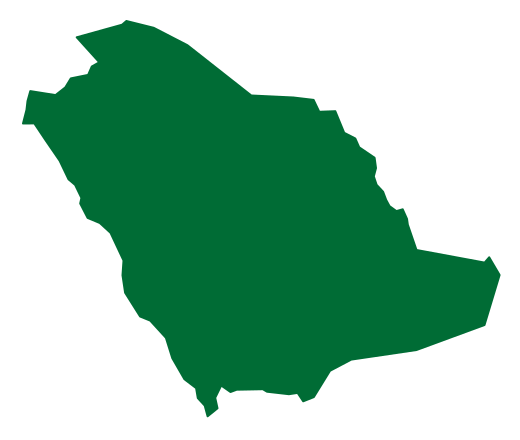
Q: Where is Khaybar located? A: In the north-west of the Arabian Peninsula, on the main trade route that passes through Makkah, Madinah, Khaybar, AlUla and Mada'in Salih.[3]
Q: What distinguishes the oasis of Khaybar naturally? A: It was formed by desert volcanic activity and is divided into a natural area holding the landscapes of the Khaybar lava field and a historical oasis that has remained a source of fresh water for thousands of years.[1]
Q: What are the most prominent archaeological remains in Khaybar? A: A Bronze Age archaeological barrier more than 15 kilometres long that contains 74 fortified enclosures, and the town of Al-Natah, whose fortified area covers 2.6 hectares.[1][4]
Q: When was the archaeological village of Al-Natah announced? A: On 30 Rabi' al-Akhir 1446 AH, corresponding to 2 November 2024, within an archaeological study published in the scientific journal PLOS ONE.[5]
Conclusion
Khaybar brings together a site associated with an event in Islamic history and an ancient oasis with Bronze Age antiquities: its fortified barrier and the town of Al-Natah testify to the depth of human settlement in the north-west of the Arabian Peninsula.[1][4] Verification of the documents attributed to it, together with the Khaybar Through the Ages project, adds fresh scholarly material to its civilisational record.[4][6]
Related topics
- HistoricKhaybar Lava FieldKhaybar Lava Field is a volcanic field in the Madinah Region of the Kingdom of Saudi Arabia and the largest harrat in the Kingdom by area, estimated at about 21,500 square kilometers. It contains Jabal Al-Qidr, listed among the world's top 100 geological sites, three rare volcanoes, and lava tubes among the longest in the Arab world.
- EventBattle of the TrenchThe Battle of the Trench, also known as the Battle of the Confederates, took place in the fifth year of the Hijrah, when the armies of Quraysh and the tribes allied with them marched on Madinah, and during the Prophetic era the Muslims dug a trench in its defence. The northern area was chosen as the main line of defence, and part of the site of the trench lies on the western side of Jabal Sal'a, where the Seven Mosques stand.
- EventBattle of BadrThe Battle of Badr is the first decisive battle fought by the Muslims. It took place on the seventeenth of Ramadan in the second year of the Hijrah between Makkah and Madinah, and its day was named the Day of the Criterion. It ended in the defeat of the polytheists, and its site in Badr Governorate preserves its landmarks and its historic route.
- EventBattle of UhudThe Battle of Uhud was fought in the third year of the Hijri calendar, corresponding to 625 CE, at Mount Uhud north of the Prophet's Mosque in Madinah. The Muslim army succeeded in protecting Madinah and repelling the attackers, and more than seventy Companions were martyred, among them Hamza ibn Abd al-Muttalib.
- EventHistory of MadinahThe history of Madinah is the history of a city in the west of the Kingdom of Saudi Arabia, known before the Prophetic Hijrah as Yathrib and later named Madinah; it is the seat of the Prophet's Mosque and the first capital of the Islamic state. Its history extends from before Islam to the Saudi era, through the building of the Prophet's Mosque and the city's historical landmarks.
- RegionMadinah RegionA western Saudi region combining Madinah, Yanbu, AlUla and other governorates, with Islamic landmarks, oases, archaeological sites and a Red Sea coastline.
- RegionAlUla CityAlUla City is a city in the north-west of the Kingdom of Saudi Arabia that brings together nature and heritage and holds the sites of ancient civilisations, most notably Hegra, the first UNESCO World Heritage site in the Kingdom, alongside Maraya Hall and heritage and geological landmarks.
- Governorate and oasis geographyGeography of AlUlaAlUla is a governorate in Madinah Region in northwestern Saudi Arabia, where cultivated oases and settlements lie among wadis and desert escarpments.
- Archaeological sitesHistory of HegraHegra, also called Mada'in Salih, is an archaeological site in AlUla Governorate whose tombs, wells and inscriptions illuminate Nabataean life and caravan routes.
Sources & references
- Royal Commission for AlUla — Khaybar Heritage Village
- King Abdulaziz Foundation for Research and Archives (Darah) — Al-Darah Journal, a study in the Prophet's biography
- King Abdulaziz Foundation for Research and Archives (Darah) — Al-Darah Journal, a study of trade routes
- Royal Commission for AlUla — Khaybar and AlUla
- Umm Al-Qura newspaper — Announcement of the discovery of a Bronze Age archaeological village in the oasis of Khaybar
- King Abdulaziz Foundation for Research and Archives (Darah) — Al-Darah Journal, a study of the document of the Jews of Khaybar
- King Abdulaziz Foundation for Research and Archives (Darah) — Al-Darah Journal, an examination of the letter attributed to the Prophet Muhammad