

Overview
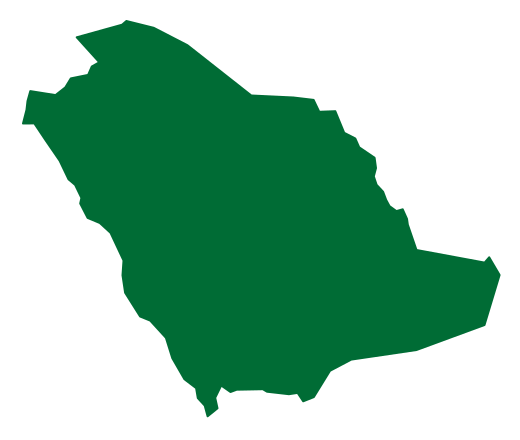
Saudi Arabia contains volcanic fields, basalt formations, craters and volcanic cones extending from the north of the Kingdom through its west and south-west, and these are among the most prominent geological evidence of ancient volcanic activity in the Arabian Peninsula.[2][3][4][5]
These formations range from basalt plateaus and columns to craters and cones, and they are distributed across several regions of the Kingdom.[2][3][4][5]
The recognition by the International Union of Geological Sciences of the basalt rocks of the Saudi volcanic fields on its global heritage stone list is a national achievement, the first of its kind in the Kingdom.[13]
Location and Distribution
In the north of the Kingdom stands Harrat al-Harrah, located within King Salman bin Abdulaziz Royal Reserve, a volcanic plateau rich in black basalt rocks with an area of about 14,000 square kilometres, lying on the border with the Hashemite Kingdom of Jordan east of Wadi Sirhan.[2]
Harrat al-Harrah contains one of the largest volcanic craters in the Kingdom, along with a number of volcanic mountains rising about 1,000 metres above sea level.[2]
In the Hail region lies Hutaymah crater, east of Jabal Salma at the far north-east of the Arabian Shield near the village of Tabah; it is 1.25 kilometres in diameter and 110 metres deep, and is among the most important geological evidence of ancient volcanic activity in the north of the Kingdom.[1]
Harrat al-Buqum lies south of Turubah governorate and is one of the most prominent volcanic fields in the region, distinguished by its rugged terrain and dark mountains threaded by several valleys, the most famous of which is Wadi Kura; it was formerly known as Harrat Nawasib.[10] The volcanic sites south of the governorate include Harrat as-Sal'a and Al-Qi'an al-Khams, along with Wadi Baydah and Wadi Ihar.[11]
Basalt Columns
Basalt columns are found across the Asir region at several sites, including Mahayel Asir governorate, Wadi Ya'ud in Al-Harajah governorate (Jabal Mushrif), Qarn Muj'al east of Tandaha centre, Wadi al-Asran, and the coastal area between Al-Qahmah and Al-Birk within the Black Mountain range.[3]
Harrat as-Sarat covers about 700 square kilometres and contains towering mountains such as Jabal Firwa', which rises 3,004 metres, and Jabal Zalm at 2,575 metres.[3]
The basalt column formations date to geological ages extending to 30 million years, and they are found in the western volcanic fields such as Harrat al-Birk, allowing researchers to study ancient volcanic activity in the Arabian Peninsula.[3]
Volcanic Craters
In Harrat Kishb lies Al-Wa'bah crater, also known as Maqlat Tumayyah and, scientifically, as a maar volcano, about 270 kilometres north-east of the city of Jeddah; it forms part of a monogenetic volcanic field containing 175 small volcanoes and covering an area estimated at about 6,000 square kilometres.[4]
The crater was selected among the top 100 geological heritage sites in the world for 2024 by the International Union of Geological Sciences (IUGS) and the United Nations Educational, Scientific and Cultural Organization (UNESCO), after an assessment by a committee of 89 international experts and from among 174 candidate sites submitted by 64 countries.[4]
Al-Wa'bah crater formed about 1.1 million years ago; it reaches a depth of about 250 metres and a diameter of 2.3 kilometres, close to three times the average diameter of other volcanoes, and it contains a salt basin or shallow lake.[4]
The crater is among the largest of its kind in the Middle East, with salt layers visible at its floor.[7]
Lake Tumayyah lies north-east of the city of Taif within Harrat Kishb, and it sits in the middle of a wide volcanic crater ringed by dark rock walls formed by ancient volcanic activity, creating a natural scene that reflects the stages of geological change in the area over thousands of years.[9]
Volcanic Cones
In Harrat Khaybar north of the Madinah region rises Jabal Qidr, a clearly defined volcanic cone rising about 400 metres, and it is among the most recently active volcanoes in the Kingdom historically.[5]
Its last eruption occurred about a thousand years ago, and it was listed among the top 100 geological sites in the world in the classification of the International Union of Geological Sciences (IUGS) and UNESCO.[5]
The volcanic Jabal al-Qidr lies in Khaybar governorate in the north-west of the Kingdom; it rises about 400 metres and was classified among the top 100 geological sites under the same classification, and Umm Jiryan cave is among the largest caves in the Arab world.[6]
Archaeological Evidence in the Volcanic Fields
Volcanic flows at Jabal Qidr covered massive stone structures known as desert kites, wide-ranging archaeological stone structures thought to date to the Bronze Age about 5,000 years ago, a convergence between volcanic activity and ancient structures in the area.[5]
Basalt on the Global Heritage Stone List
The basalt of the volcanic fields is one of the geological markers holding a natural and cultural legacy in the west of the Kingdom, after its recognition as the first Saudi heritage stone on the global heritage stone list of the International Union of Geological Sciences (IUGS).[12]
The volcanic fields of the Madinah region hold prominent evidence of this legacy, most notably Harrat Rahat and Harrat Khaybar.[12]
Scientific Research in the Craters
Tourism and nature
Frequently Asked Questions
Q: What are the volcanoes in Saudi Arabia? A: They are volcanic fields, basalt formations, craters and cones extending from the north of the Kingdom through its west and south-west, and they are evidence of ancient volcanic activity in the Arabian Peninsula.[2][3]
Q: Where are the volcanic fields distributed in the Kingdom? A: In the north of the Kingdom, where Harrat al-Harrah lies; in the Hail region, where Hutaymah crater lies; in the Madinah region, where Harrat Khaybar and Harrat Rahat lie; in Turubah governorate, where Harrat al-Buqum lies; and in the Asir region, where Harrat as-Sarat lies.[1][2][3][10][12]
Q: What are the most prominent volcanic craters in Saudi Arabia? A: Al-Wa'bah crater (Maqlat Tumayyah) in Harrat Kishb, Hutaymah crater in the Hail region, and Lake Tumayyah north-east of Taif.[1][4][9]
Q: Which volcanoes in the Kingdom were most recently active? A: Jabal Qidr in Harrat Khaybar, which is among the most recently active volcanoes in the Kingdom historically, as its last eruption occurred about a thousand years ago.[5]
Q: What is the global standing of the volcanoes in Saudi Arabia? A: Al-Wa'bah crater was selected among the top 100 geological heritage sites in the world for 2024, Jabal Qidr was listed among the top 100 geological sites in the world, and the basalt of the volcanic fields was recognised as the first Saudi heritage stone on the list of the International Union of Geological Sciences.[4][5][12]
Related topics
- HistoricHarrat Al-Harrah ReserveHarrat Al-Harrah Reserve is a high-conservation natural area in northwestern Saudi Arabia, extending across the Northern Borders and Al-Jawf regions within the boundaries of the King Salman bin Abdulaziz Royal Reserve. It features a volcanic plateau and plant and wildlife diversity, and is the first reserve established by the Saudi Wildlife Authority.
- HistoricKhaybar Lava FieldKhaybar Lava Field is a volcanic field in the Madinah Region of the Kingdom of Saudi Arabia and the largest harrat in the Kingdom by area, estimated at about 21,500 square kilometers. It contains Jabal Al-Qidr, listed among the world's top 100 geological sites, three rare volcanoes, and lava tubes among the longest in the Arab world.
- HistoricHarrat RahatHarrat Rahat is a vast volcanic field in the Kingdom of Saudi Arabia whose lava flows extend from the north of Makkah to Madinah, and it contains lavas formed over widely separated periods, running from millions of years ago to the last volcanic eruption in 654 AH. Its recent volcanic activity is concentrated in its northern part, along the southern and eastern edges of Madinah.
- HistoricKing Salman bin Abdulaziz Royal Nature ReserveKing Salman bin Abdulaziz Royal Nature Reserve is a royal nature reserve in the northwest of the Kingdom of Saudi Arabia and the largest reserve in the Middle East, with a total area of 130,700 square kilometres extending across four administrative regions. It contains broad biodiversity and rock art sites inscribed on the UNESCO World Heritage List.
- HistoricAja and Salma MountainsThe Aja and Salma mountains are two mountain ranges in the Hail Region and among its most famous natural and heritage landmarks, forming a destination for environmental and mountain tourism and for archaeological sites that include the palace of Hatim al-Ta'i and Darb Zubaydah [1].
- HistoricWadi SirhanWadi Sirhan is a wadi in the Al-Jawf region of northern Saudi Arabia and the longest and best-known wadi of the region, with a length of 180 km. It occupies the northern part of the region, where the surface falls below 300 m above sea level, and its name is linked to the project to settle the Bedouin and spread agriculture from 1380 AH.
- RegionHail RegionA north-central Saudi region administered from Hail, associated with the Aja and Salma mountains, the Nafud desert, historical caravan routes and varied regional activities.
- RegionMadinah RegionA western Saudi region combining Madinah, Yanbu, AlUla and other governorates, with Islamic landmarks, oases, archaeological sites and a Red Sea coastline.
- RegionAsir RegionA southwestern Saudi region administered from Abha, combining Sarawat highlands, Tihamah and the coast, with agricultural terraces, historic villages and distinctive local cultural traditions.
- RegionTaif CityTaif City is a Saudi city in the west of the Kingdom, known as the “City of Roses and Bride of Saudi Summer Resorts” for its moderate summer climate and its natural views in Al-Shafa and Al-Hada. It contains more than 700 rose farms, farms of seasonal fruits, and cultural and historical landmarks including Souq Okaz and Shubra Palace.
- HistoricRock Art of HailThe Rock Art of Hail is a World Heritage property in the Hail Region of Saudi Arabia, inscribed on the UNESCO list in 2015, comprising the largest rock art complexes in the Arabian Peninsula with engravings spanning about 10,000 years.
- HistoricHarrat KishbHarrat Kishb is a volcanic lava field within Taif Governorate that contains Al-Wa'bah Crater, also known as Maqla' Tumaiy and Tumaiy Lake. It forms part of a monogenetic volcanic field of 175 small volcanoes, and Al-Wa'bah Crater is the deepest volcanic crater in the Kingdom of Saudi Arabia.
Sources & references
- Saudi Press Agency (SPA) — Hutaymah crater in the Hail region
- Saudi Press Agency (SPA) — Harrat al-Harrah in King Salman bin Abdulaziz Royal Reserve
- Saudi Press Agency (SPA) — Basalt columns in the Asir region
- Saudi Press Agency (SPA) — Al-Wa'bah crater (Maqlat Tumayyah) among the top 100 geological heritage sites
- Saudi Press Agency (SPA) — Jabal Qidr in Harrat Khaybar
- Saudi Press Agency (SPA) — Jabal al-Qidr and Umm Jiryan cave in Khaybar governorate
- Saudi Press Agency (SPA) — Al-Wa'bah crater in Al-Muwayh
- Saudi Press Agency (SPA) — Bacterial life in Al-Wa'bah crater
- Saudi Press Agency (SPA) — Lake Tumayyah in Harrat Kishb
- Saudi Press Agency (SPA) — Harrat al-Buqum south of Turubah governorate
- Saudi Press Agency (SPA) — Volcanic sites south of Turubah governorate
- Saudi Press Agency (SPA) — Basalt of the volcanic fields on the global heritage stone list
- Saudi Press Agency (SPA) — IUGS recognition of basalt rocks in the Saudi volcanic fields