 Historical events
Image credits
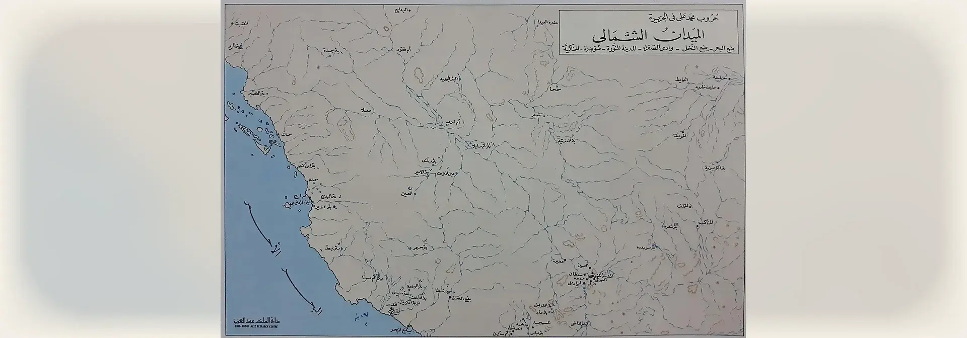
Image attribution: Map «Muhammad Ali's Wars in the Arabian Peninsula – The Northern Battlefields (Yanbu al-Bahr, Yanbu al-Nakhl, Wadi al-Safra, Medina, Suwaydira, al-Hanakiyah)» from «The Historical Atlas of the Saudi State» (1972) by the late Dr. Ibrahim Jumaa, published by the King Abdulaziz Foundation; file uploaded by User:Tarawneh on Wikimedia Commons. License: Public domain (PD-Saudi Arabia); attribution not required. The 2864×1844 original was placed complete — no crop, no enlargement — on a 1920×672 cream canvas with a blurred backdrop taken from the map itself, to match the article cover. Honest disclosure: a printed textual publisher imprint «دارة الملك عبد العزيز / KING ABDUL AZIZ RESEARCH CENTRE» sits at the map's bottom-left; it belongs to the original 1972 atlas printing, not an added platform mark. / خريطة «حروب محمد علي في شبه الجزيرة العربية – الميادين الشمالية (ينبع البحر – ينبع النخل – وادي الصفراء – المدينة المنورة – سويدرة – الحناكية)» من «الأطلس التاريخي للدولة السعودية» (1972) لعمل المرحوم د. إبراهيم جمعة، إصدار دارة الملك عبد العزيز؛ رفع الملف User:Tarawneh على ويكيميديا كومنز. الرخصة: ملكية عامة (Public domain / PD-Saudi Arabia)، لا يُشترط الإسناد. الملف الأصلي 2864×1844، وُضع كاملاً دون قص ولا تكبير على كانفس كريمي 1920×672 بخلفية مموّهة من الخريطة نفسها ليطابق غلاف المقالة. إعلان بصدق: أسفل يسار الخريطة ختم ناشر مطبوع نصّي نصّه «دارة الملك عبد العزيز / KING ABDUL AZIZ RESEARCH CENTRE» وهو من طبعة الأطلس الأصلية (1972) لا علامة منصة مضافة. · License: Public domain (PD-Saudi Arabia)
1226هـ
The Battle of Wadi Al-Safra was a battle fought in 1226 AH near Madinah, and it is one of the major battles in the history of the First Saudi State. The Saudi forces in it were led by Imam Abdullah bin Saud bin Abdulaziz, after his father Imam Saud bin Abdulaziz called for unifying the ranks and defending the land, and it ended with the defeat of Tusun bin Muhammad Ali Pasha.
Read article→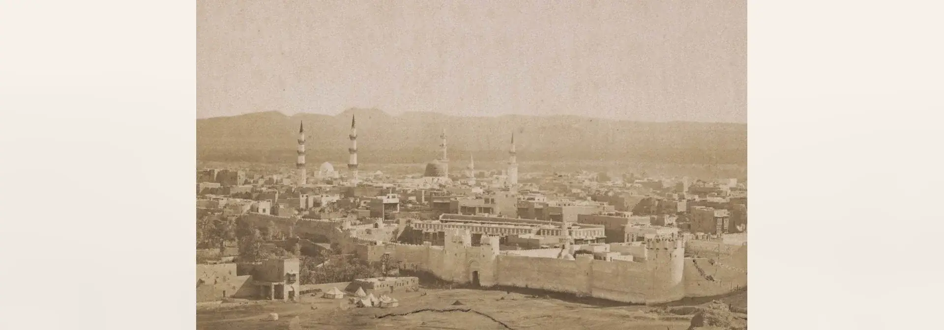 Urban history
Image credits
Image attribution: Khalili Collections — "A General View of Medina", an early historical photograph from the Hajj and Arts of Pilgrimage collection. Source: Wikimedia Commons (file page: https://commons.wikimedia.org/wiki/File:Khalili_Collection_Hajj_and_Arts_of_Pilgrimage_arc.pp_0211.09_CROP.jpg), licensed Creative Commons Attribution-ShareAlike 3.0 IGO (CC BY-SA 3.0 IGO). Modified: scaled to fit a 1920×672 frame on a blurred backdrop, without cropping. / مجموعة خليل (Khalili Collections) — «منظر عام للمدينة المنورة» (A General View of Medina)، صورة فوتوغرافية تاريخية من مجموعة الحج وفنون الحجّ. المصدر: ويكيميديا كومنز (صفحة الملف: https://commons.wikimedia.org/wiki/File:Khalili_Collection_Hajj_and_Arts_of_Pilgrimage_arc.pp_0211.09_CROP.jpg)، رخصة Creative Commons Attribution-ShareAlike 3.0 IGO (CC BY-SA 3.0 IGO). عُدِّلت: صُغِّرت لتلائم إطار 1920×672 على خلفية مموّهة، دون قصّ. ·
License: CC BY-SA 3.0 IGO قبل الهجرة النبوية – العهد السعودي
The history of Madinah is the history of a city in the west of the Kingdom of Saudi Arabia, known before the Prophetic Hijrah as Yathrib and later named Madinah; it is the seat of the Prophet's Mosque and the first capital of the Islamic state. Its history extends from before Islam to the Saudi era, through the building of the Prophet's Mosque and the city's historical landmarks.
Read article→ Historical events
Image credits
Image attribution: Yasser.Bakhsh — «موقع غزوة بدر» (site of the Battle of Badr), photograph (4998×3332 px) of the battle plain at Badr. Source: Wikimedia Commons, file page https://commons.wikimedia.org/wiki/File:Battle_of_Badr_1.jpg , licensed under Creative Commons Attribution-ShareAlike 4.0 International (CC BY-SA 4.0), https://creativecommons.org/licenses/by-sa/4.0/ . Modified: downscaled (no upscaling, no cropping) and placed whole on a cream 1920×672 canvas. / ياسر بخش (Yasser.Bakhsh) — «موقع غزوة بدر»، صورة فوتوغرافية (4998×3332 بكسل) لساحة المعركة في محافظة بدر. المصدر: ويكيميديا كومنز، صفحة الملف https://commons.wikimedia.org/wiki/File:Battle_of_Badr_1.jpg ، رخصة المشاع الإبداعي نَسب المُصنَّف – المشاركة بالمثل 4.0 الدولية (CC BY-SA 4.0)، https://creativecommons.org/licenses/by-sa/4.0/ . عُدِّلت: صُغِّرت الصورة (بلا تكبير وبلا قص) ووُضعت كاملة وسط إطار كريمي 1920×672. ·
License: CC BY-SA 4.0 2هـ
The Battle of Badr is the first decisive battle fought by the Muslims. It took place on the seventeenth of Ramadan in the second year of the Hijrah between Makkah and Madinah, and its day was named the Day of the Criterion. It ended in the defeat of the polytheists, and its site in Badr Governorate preserves its landmarks and its historic route.
Read article→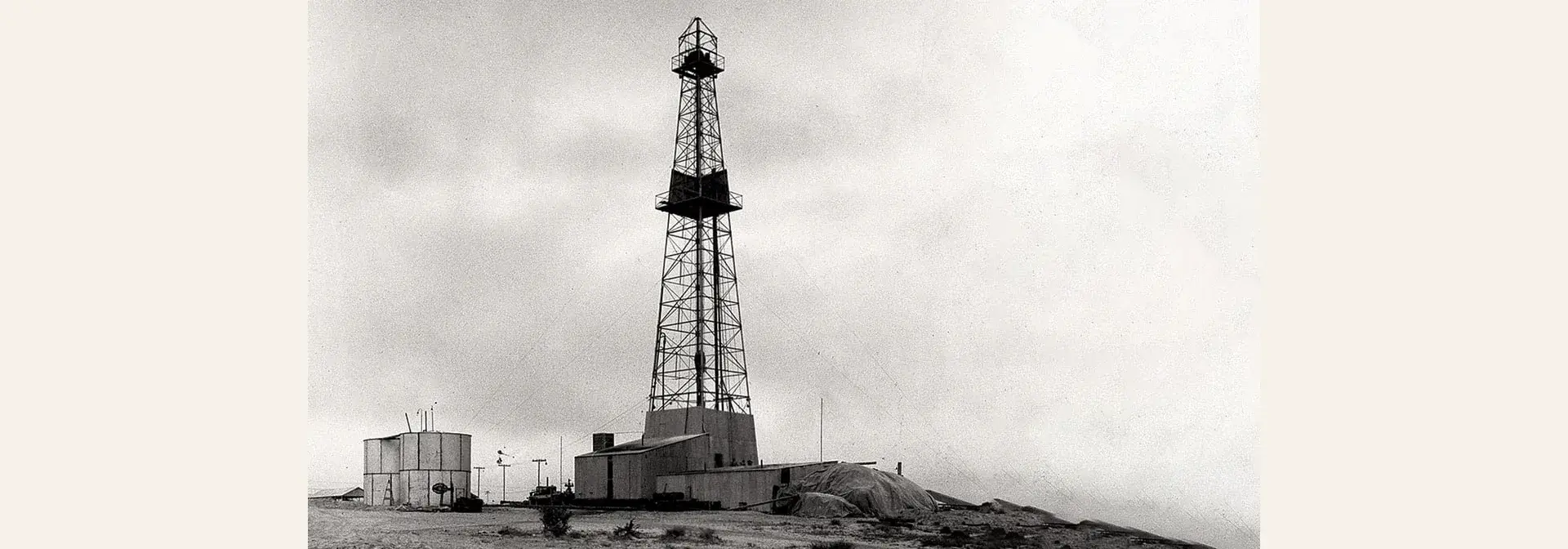 Historical events
Image credits
Image attribution: Dammam Well No. 7, 1938 — unknown author, Aramco archive (aramcolife), public domain (PD-Saudi Arabia), via Wikimedia Commons; image placed uncropped and unscaled on a neutral 1920×672 canvas for the article cover. / بئر الدمام رقم 7 عام 1938 — مؤلف غير معروف، أرشيف أرامكو (aramcolife)، ملكية عامة (PD-Saudi Arabia)، عبر ويكيميديا كومنز؛ وُضعت الصورة كاملةً بلا قص ولا تكبير على خلفية محايدة 1920×672 لتلائم غلاف المقالة. · License: Public domain (PD-Saudi Arabia)
1933–1939
The discovery of oil in Saudi Arabia is a historic event that began with the signing of the oil exploration concession on 29 May 1933 and was crowned by Dammam Well No. 7 when it produced oil on 4 March 1938, after which the Kingdom exported its first shipment of oil on 1 May 1939.
Read article→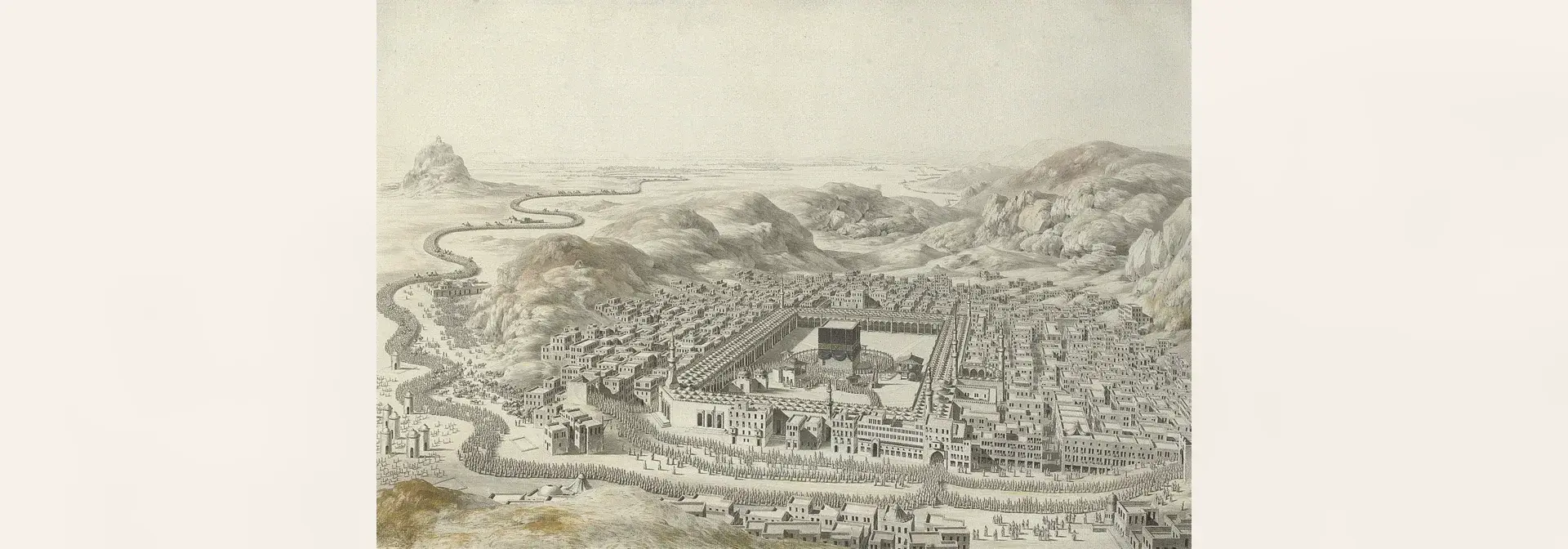 Urban history
Image credits
Image attribution: Louis-Nicolas de Lespinasse, "Mecca (La Mecque)", 1787 — pencil, ink, grey wash and watercolour on paper. Source: Wikimedia Commons. License: Public domain. / لويس-نيكولا دي ليسبيناس (Louis-Nicolas de Lespinasse)، «مكة» (La Mecque)، 1787 — رصاص وحبر وغسل رمادي وألوان مائية على ورق. المصدر: ويكيميديا كومنز. الرخصة: ملكية عامة (Public domain). · License: Public domain
ق1هـ–1441هـ
The history of Makkah is a continuous record from the age of Ibrahim, peace be upon him, and the building of the Holy Kaaba to the Saudi era, embracing antiquities, landmarks, scholars, endowments and services for pilgrims. Its events are spread across the Mamluk era and the Ottoman period, then the educational and regulatory renaissance in the Kingdom of Saudi Arabia.
Read article→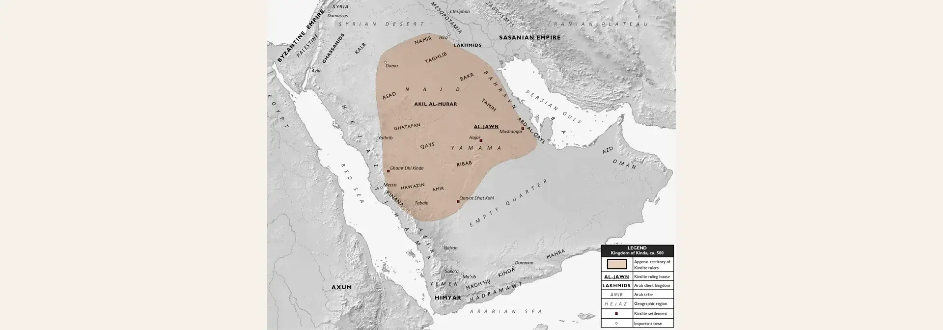 Archaeological sites
Image credits
Image attribution: Map: Al Ameer son — “Kindite Kingdom, ca. 500” (own work) — Source: Wikimedia Commons, file “Kindite Kingdom, ca. 500.png” — https://commons.wikimedia.org/wiki/File:Kindite_Kingdom,_ca._500.png — License: CC BY-SA 4.0 (Creative Commons Attribution-ShareAlike 4.0) — https://creativecommons.org/licenses/by-sa/4.0 — Modified: the full map was placed at its original size 1573×1270, uncropped and not enlarged (downscaled only to a height of 672), on a 1920×672 canvas over a soft cream (#f4efe5) backdrop derived from the map itself. / خريطة: Al Ameer son — «Kindite Kingdom, ca. 500» (عمل شخصي) — المصدر: ويكيميديا كومنز، ملف «Kindite Kingdom, ca. 500.png» — https://commons.wikimedia.org/wiki/File:Kindite_Kingdom,_ca._500.png — الرخصة: CC BY-SA 4.0 (المشاع الإبداعي نَسب المُصنَّف – الترخيص بالمثل 4.0) — https://creativecommons.org/licenses/by-sa/4.0 — عُدِّلت: وُضعت الخريطة كاملة بحجمها الأصلي 1573×1270 دون قصّ ولا تكبير (تصغير فقط إلى ارتفاع 672) على كانفس 1920×672 بخلفية كريميّة مموّهة (#f4efe5) مشتقّة من الخريطة نفسها. ·
License: CC BY-SA 4.0 منتصف الألف الأول قبل الميلاد – القرن الخامس الميلادي
The Kingdom of Kinda was an ancient Arabian entity built on a federal organisation of Arabian desert tribes, with the archaeological city of Qaryat al-Faw in Wadi ad-Dawasir Governorate as its capital. The Cultural Landscape of the Al-Faw Archaeological Area was inscribed on the World Heritage List in 2024 CE, and it is managed by the Heritage Commission of the Ministry of Culture and the National Centre for Wildlife.
Read article→